Beaudry Bountiful

Hike Beaudry Loop for Gorgeous Mountain Vistas
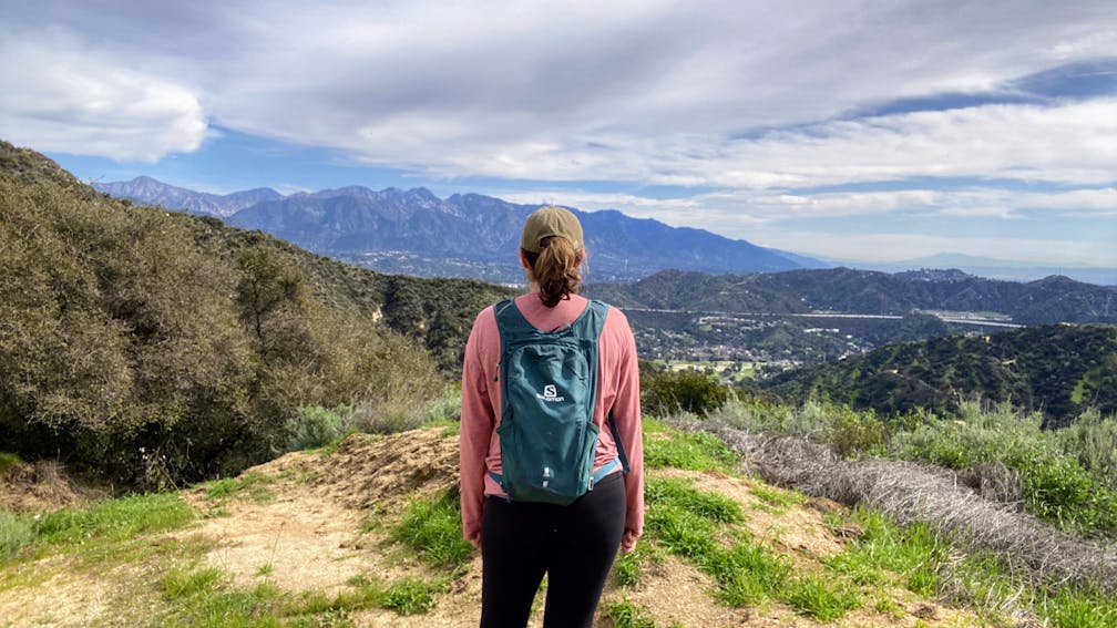
There are no cars allowed on Beaudry Loop, but for reasons unknown its trails are called motorways. But one thing we know for sure: This 6-miler will take you on a wild ride. You’ll be climbing 1,500 feet up the southern Verdugos along a chaparral-lined trail with gorgeous mountain and urban vistas every step of the way.

Start your engines on a residential street in Glendale. Pass the gate and walk a half-mile past the dam until you reach the junction of Beaudry North and Beaudry South Motorways, marked by a yellow metal sign. Heading in either direction is fine, but locals agree the northern motorway offers a gentler ascent. 

The wide dirt road twists up along the ridgeline at a steady incline, offering lovely views of the Crescenta Valley and the San Gabriel Mountains. After passing a rusted water tower, make a sharp left on the trail towards the Verdugo Motorway to find a striking radio tower locked behind a fence. Take the small elevated path along the fence’s edge to reach the 2,656-foot Tongva Peak. Here you’ll discover a concrete bench and a serene lookout point of Burbank, Griffith Park, and downtown Los Angeles.

After reaching the second radio tower at Mount Thom, the road splits. Keep left to descend down Beaudry South to complete the loop. 

TIP: This unshaded trail is best enjoyed in the winter or spring months. Avoid hiking this trail on extremely hot days, or go early in the morning to beat the heat. Regardless of season, we recommend plenty of water and sunscreen.

From CA-2 in Glendale, exit onto Mountain St. and head west. Turn right onto N. Verdugo Rd., and then veer left onto Cañada Blvd. Make lefts onto Country Club Dr. and then Beaudry Blvd. Find the trailhead on the left at the intersection of Beaudry Blvd. and Beaudry Terr. Street parking only. Dog friendly.

Story and photos by Yvonne Pasquini, @yvonne_pasquini

Trending Stories NorCal

View all Stories
  1. All right, Almaden!

    Take a trip through time on this 5-mile loop in Almaden Quicksilver County Park. Explore the ruins of an old cinnabar mine and enjoy the first hints of wildflower season.

    View
  2. Waterfalls and Wine Pours

    Cooler temps, green hills, and the return of our magnificent waterfalls! This family-friendly 2-mile hike at Uvas Canyon County Park in Morgan Hill is a great way to get the most out of a short hike post-rain.

    View
  3. Woman hiker is climbing up the ladder in the Steep Ravine section of the Dipsea Loop Trail on Mount Tam

    Misty on Mount Tam

    Mount Tam’s 3.9-mile round-trip Steep Ravine and Dipsea Trail Loop weathers the wets and wilds with some confidence, sheltered in parts by redwoods, and wowing with a waterfall.

    View
  4. Mile-Long Cataract Club

    In winter after heavy rains, the north flank of Mount Tam glows with flows. The nearly mile-long series of waterfalls—Cataract Falls—transforms into a supercharged spectacle. Starting at Alpine Dam, a 1.6 mile (one-way) narrow trails threads through redwoods and ferns along Cataract Creek.

    View

Trending Stories SoCal

View all Stories
  1. Sponsored

    Hidden Gems of Reno Tahoe

    Step into a land where adventure meets relaxation. Reno Tahoe is where the spirit of the great outdoors and the energy of vibrant city life inspire you to live with no limits.

    View
  2. Peace Labyrinth

    Hidden in LA’s historic West Adams district, the Peace Awareness Labyrinth & Gardens is a welcome respite from the norms of urban noise.

    View
  3. Weekend Sherpa Podcast: Take It Outside

    Adventure for your earbuds. What's new in the world of the outdoors? Listen to Weekend Sherpa co-founders discuss local hikes, beaches, bike rides, camping spots and all kinds of travel and adventure in California and beyond!

    View
  4. Hikers sitting on a large rock slab next to Three Sisters Falls in Cleveland National Forest Southern California near Julian

    Three Sisters

    Good things come in threes at this hike to a lovely trio-tiered waterfall in Cleveland National Forest. The 4.25-mile out-and-back hike rambles among rolling hills, with rocky mountain views as switchbacks take you down to a lush canyon and the falls.

    View