Hike the Dunes to the Beach
Hike Bodega Bay Sand Dunes to Salmon Creek Beach


Bodega Head is popular for its impressive cliff-hugging hiking trails, but few people follow the path north to a less-trodden hiking trail winding along the bluff and down to spectacular South Salmon Creek Beach.
To make this 4-mile (round-trip) journey from the Bodega Head parking lot, follow the trail north up along a dramatic bluffside until you reach a sign pointing the way to Salmon Creek Beach. You'll pass through the UC Davis Bodega Marine Reserve and across sand dunes covered in tall coastal grasses.


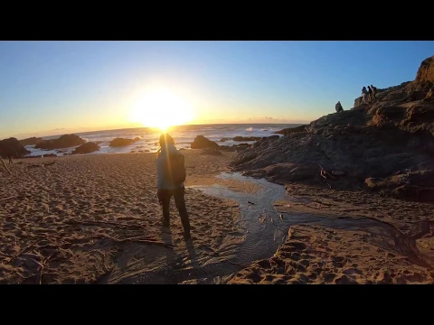
It’s likely you’ll have the trail all to yourself. After passing through the Marine Reserve, follow trail posts though sand dunes to the beach (a sign points to Salmon Creek Beach). Follow the trail until you reach a large resting area with picnic tables.

At this point, you’ll see a gently rising sand dune. You can’t see beyond it, so climb over it and descend to South Salmon Creek Beach (pretty much any nearby route you take at this point will deliver you to the beach). South Salmon Creek Beach is normally quiet this time of year, inhabited only by giant driftwood. Walk the dune-backed beach (just remember where you entered), or spread a blanket and relax for a while. Returning the way you came is equally rewarding, as the hike offers views of Tomales Bay.


BONUS: When you reach the trail sign to Horseshoe Cove (about a quater-mile from the parking lot), take the quick detour out to the rocky mounds overlooking the sea and the Marine Laboratory. Late day is the best time to be here to avoid major crowds and to witness the sun sinking into the horizon, brightening the ocean waves and coloring the clouds pink.
From Highway 1 in Bodega Bay, make a left on East Shore Rd. Go half a mile and turn right on West Shore Rd. Go another 3.5 miles to Bodega Head’s west parking lot. Take the signed trail north of the parking lot going up the bluffs. Return the way you came. No dogs.







