Ojai and Mighty

Hike the Kennedy Ridge Trail

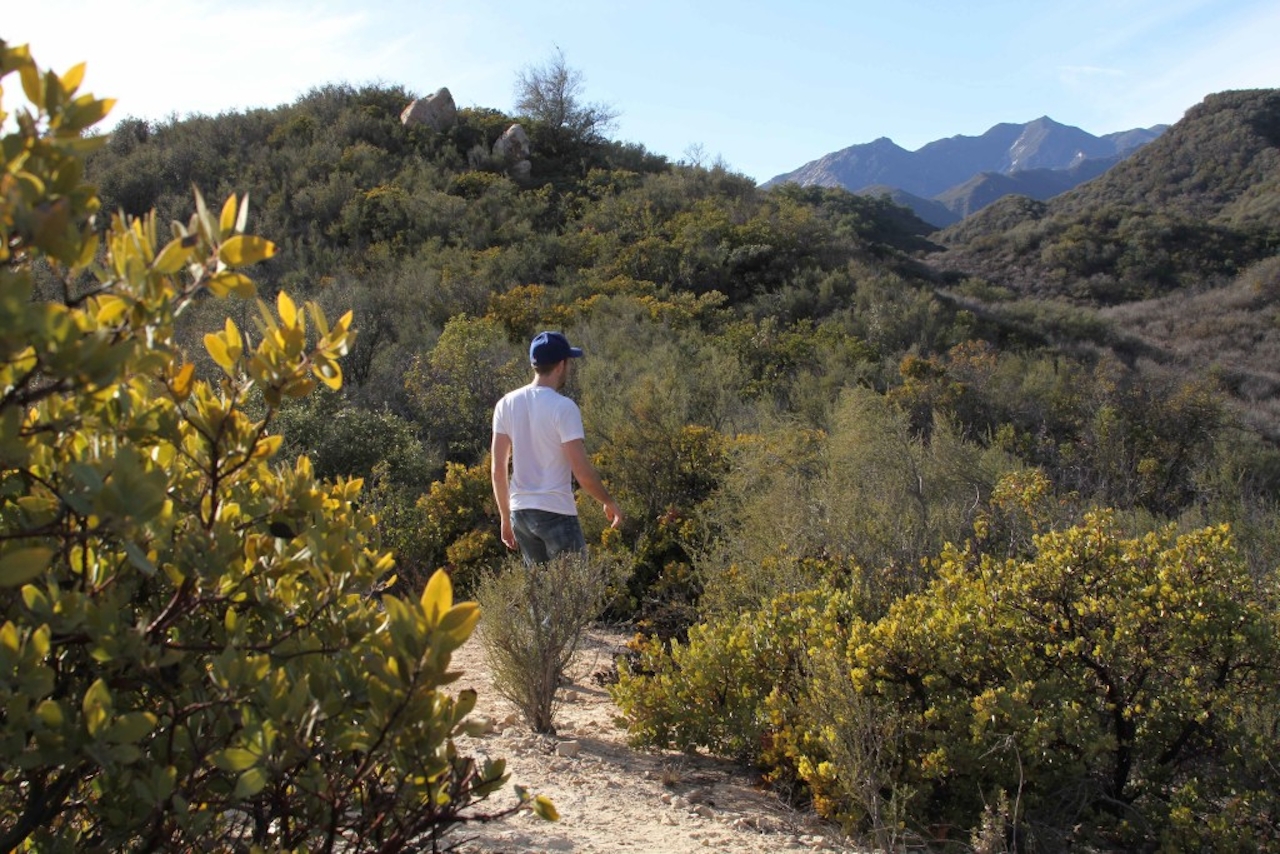
Blazed just over five years ago, Kennedy Ridge Trail climbs into a chaparral region above Ojai Valley once accessible only to wild creatures and the most daring bushwackers. Visit the Ojai Valley Land Conservancy's Ventura River Preserve to hike this 5-mile out-and-back route ascending 1,000 feet to a low ridge of the Santa Ynez Mountains in Los Padres National Forest. Starting at Oso Trailhead, cut west over the Ventura River's rocky bed and up a slope to an old dirt road adjacent to an abandoned orange grove. From there, junction signs point the way to Kennedy Ridge Trail (via Rice Canyon Trail), leading you past a small stand of peppertrees, eucalyptus, and giant flowering agaves to a bridge over Los Robles Diversion Canal. Walk along a red-soil service road through oaks and grasslands before taking a narrow diverging trail up a sage-covered hillside. The next mile is a series of steep, heart-pumping switchbacks rising to the ridge. Most of the way you'll be enveloped in a thicket of tall shrubs. Once up, sit at a picnic table to the east and get views of the Nordhoff Ridge and Topatopa Mountains. The path continues west for one mile along an undulating ridge dotted with sandstone outcroppings—its back side rippling up towards the distant White Ledge Peak. A second table marks the trail's end, where you'll enjoy a panorama of Lake Casitas, the Ojai Valley, and the Pacific Ocean.
kennedy_ridge101-image-jpeg

From Los Angeles, take US-101 north to Ventura, then CA-33 to Meiners Oaks. Trailhead parking is located at the end of Meyer Rd., just off Rice Rd., next to the Ojai Valley Trail Riding Company. The lot closes at 5:00 p.m. during winter months. Dog-friendly!

Trending Stories NorCal

View all Stories
  1. Napa Valley Paddle kayaker and paddle boarder on the Napa Valley river

    Napa's Wild Side

    It’s wine country’s Amazon. The gentle Napa River is an ecological—and recreational—delight. And Napa Valley Paddle sets you up for maximum enjoyment of this experience.

    View
  2. Been There, Dome That

    Surrounded by granite domes, craggy peaks, and miles of hiking trails, the High Sierra landscape of Tuolumne Meadows in Yosemite National Park is famous for good reason. For a truly grand view, take a short hike to bold—and bald (except for snow at times)—Lembert Dome.

    View
  3. Wapama Wows

    Hetch Hetchy can be overlooked in Yosemite National Park because of its more remote location and limited facilities. But this is where you’ll also find one of the best day hikes in the park: Wapama Falls.

    View
  4. Hike Mount Tamalpais into Muir Woods

    Muir Woods Through the Backdoor

    A backdoor entrance into Muir Woods? Hike a tranquil trail that starts in Mount Tamalpais State Park and quietly leads into Muir Woods, letting you avoid the busyness of the main parking area.

    View

Trending Stories SoCal

View all Stories
  1. Inn-spiration Point!

    For more than a century, people have been hiking or mountain biking to West Point Inn for good reason. Perched at 1,785 feet on the southern slope of Mount Tamalpais, the historic inn has sweeping views from the Marin Headlands to the San Francisco skyline.

    View
  2. A Thousand Steps to Paradise

    A picture is worth a thousand words, but is a gorgeous beach in Laguna worth a thousand steps? The answer is yes, though the question is moot, because it’s only 223 steep steps down to the 400-yard stretch of sand known as 1000 Steps Beach.

    View
  3. Sponsored

    Take the Exit to the Best of the San Francisco Peninsula

    The San Francisco Peninsula is proof that some of Northern California’s greatest surprises are hiding just off Highway 101. All you have to do is take the exit.

    View
  4. Hike to the Sierra Buttes Fire Lookout in the Lakes Basin

    Lookout for This View!

    Sierra Buttes Lookout, at a lofty 8,591 feet, is a memory maker for its pucker-worthy stairway to the tower’s balcony. It's a 5-mile (round-trip) hike to reach it. And the reward? Epic!

    View





