Glow Up

Hike to Beacon Hill in Griffith Park Los Angeles

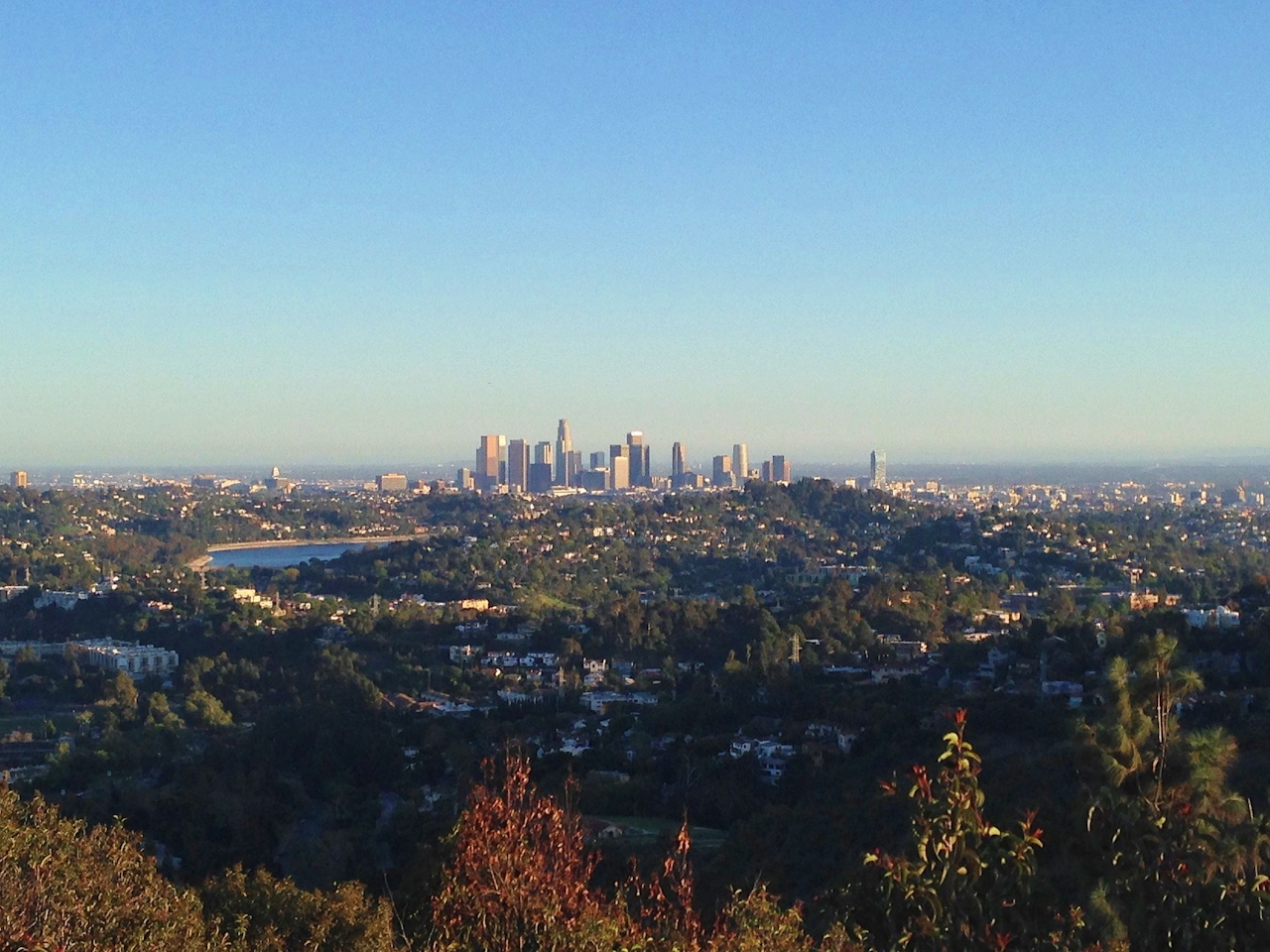
Tucked in the southeast corner of Griffith Park, Beacon Hill is an example of how you don’t have to travel far or aim high to reach one of the best panoramas of LA’s skyline.

Before LAX came into the picture, Glendale had LA’s principal airport, complete with a shining beacon on the Santa Monica range’s easternmost summit. The light’s gone, but Beacon Hill, at 1,001 feet, still beams. Get to its summit in 2 miles and just 500 feet of elevation.
undefined

From the apex, downtown LA is only about 5 miles away, with views extending clear across the city to Santa Monica Bay, shining next to the Palos Verdes Peninsula. The Verdugo Mountains and the San Gabriels tower to the north and east above Glendale and Burbank. Spin around—Mount Bell and Mount Hollywood form the crown of Griffith Park. Complete the loop by hiking down Coolidge Trail and Lower Beacon Trail, which gives closer looks at downtown and the Los Angeles River.

Take I-5 to the Los Feliz Blvd. exit north of downtown Los Angeles. Drive west to the first intersection and turn right on Crystal Springs Rd. After 1.3 miles, turn left, following signs for the merry-go-round. Go a quarter mile to a barricade in the road and turn right into the merry-go-round parking lot. Walk up the road a few hundred feet past the barricade to the third trail on the left (just in front of another barricade crossing the pavement). Stay to the left through two junctions at the bottom of Fern Canyon Trail, and hike 1.15 miles up to a 5-way junction. Turn left, and proceed 0.2 mile to the top of Beacon Hill. Return to the 5-way junction and turn left on Coolidge Trail to continue the loop. Drop one mile past the Tregnan Golf Academy Driving Range and turn left up Lower Beacon Trail to return 1.25 miles to the trailhead. All trails are wide fire roads, but junctions are unmarked. Dog-friendly!

Trending Stories NorCal

View all Stories
  1. Purely Purisima

    Take a relaxing hike on the lower section of Purisiima Creek Trail in Purisima Creek Redwoods Open Space Preserve.

    View
  2. Been There, Dome That

    Surrounded by granite domes, craggy peaks, and miles of hiking trails, the High Sierra landscape of Tuolumne Meadows in Yosemite National Park is famous for good reason. For a truly grand view, take a short hike to bold—and bald (except for snow at times)—Lembert Dome.

    View
  3. Wapama Wows

    Hetch Hetchy can be overlooked in Yosemite National Park because of its more remote location and limited facilities. But this is where you’ll also find one of the best day hikes in the park: Wapama Falls.

    View
  4. Sponsored

    Take the Exit to the Best of the San Francisco Peninsula

    The San Francisco Peninsula is proof that some of Northern California’s greatest surprises are hiding just off Highway 101. All you have to do is take the exit.

    View

Trending Stories SoCal

View all Stories
  1. Ballona Beach Hopper

    This easygoing bike escape is proof that you don't have to drive for hours to feel the vast benefits of nature. The Ballona Creek Bike Path is part of the “Park to Playa Regional Trail,” a 13-mile network connecting parks and open spaces from Baldwin Hills to the Pacific Ocean.

    View
  2. Lookout Ahead!

    A 3.7-mile loop hike to Boucher Hill Fire Lookout in Palomar Mountain State Park reminds us just how stunningly beautiful are the mountains of this remote, lightly visited portion of northern San Diego County.

    View
  3. A Thousand Steps to Paradise

    A picture is worth a thousand words, but is a gorgeous beach in Laguna worth a thousand steps? The answer is yes, though the question is moot, because it’s only 223 steep steps down to the 400-yard stretch of sand known as 1000 Steps Beach.

    View
  4. Strawberry Peak Lookout Hike

    Strawberry Sunday

    The 2.5-mile (round-trip) lollipop loop climb to the Strawberry Peak Fire Lookout near the town of Lake Arrowhead dishes up some delicious views.

    View





