Best Foot Forward

Hike to Panoramic Views at Foothills Park in Palo Alto

Woman on hiking trail at Foothills Park in Palo Alto

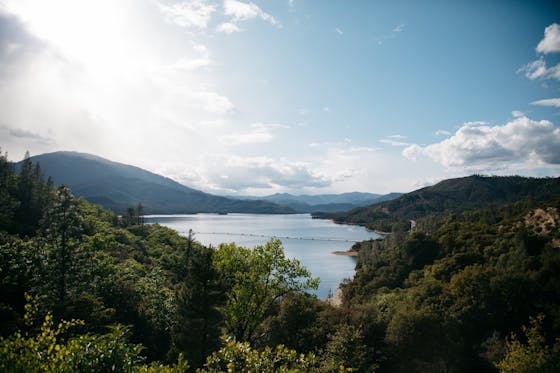
Recently opened to non-Palo Alto residents, Foothills Park has 15 miles of trail surrounded by misty valleys, tender oak trees, seasonal creeks, a peaceful lake, and beautiful Bay Area vistas.

Unfortunately, too much of a good thing led to too many folks visiting the park at once! So Foothills has had to create new ways to manage crowds, and we can all be part of the solution by planning ahead. The park closes when capacity is reached, so you have to keep apprised of updates, which may come to include a parking fee. Still, if you can go, go respectfully (and be sure to have your face mask!). Here are recommended hikes:

Start at Orchard Glen at the junction of Las Trampas and Wildhorse Valleys, a prime location with trails radiating from the parking area. For a moderately rolling loop through highlights of the park, try the Foothills Highlights Loop, a 3.2-mile hike to Boronda Lake, Vista Hill, and Arbolejo Overlook with views of the Stanford Dish and Hoover Tower. On a clear day, Vista Hill boasts a 180-degree panorama of Mount Tamalpais, Mount Diablo, and the San Francisco Bay. Tiny telescopes encased inside wooden posts provide up-close views. To begin, head south to Wildhorse Valley and hike the Toyon, Woodrat, and Chamise Trails counter-clockwise.

Man hiking a trail overlooking Palo Alto at Foothills Park

If it’s elevation you’re after, head to the Los Trancos Trail, an 8-mile loop with heart-pumping climbs, woodlands, and panoramas below Los Trancos Preserve. While you could hike the whole shebang, it’s possible to take a shortcut and do a 4.8-mile, 1,000-foot-gain loop. For this, head west to Las Trampas Valley and pick up the Los Trancos Trail across from the Interpretive Center. Then, hop on the shortcut—Trappers Fire Road—for 1.3 miles, and climb to 270-degree vistas of the Coast and Diablo Ranges. Reconnect to the Los Trancos Trail, descending eight wooden bridges to Wildhorse Valley. 

undefined

Before you go check for updates on park times and closures and any new systems put in place to manage the park's traffic. Take exit 20 off I-280 to Page Mill Rd., heading south. Drive 2.5 miles to the Foothills Park entrance on your right. Drive through the park, bearing left at the sign for the Interpretive Center, and park at the Orchard Glen Picnic Area. Park hours are 8 a.m. to sunset. No fee. Leashed dogs allowed on weekdays and non-city holidays. Download a trail map on the park’s webpage. Non-motorized, hand-launched boats are allowed in Boronda Lake. Tent camping is available at Towle Camp (May 1 through October 31, reservations required). There are restrooms in the park. Note: Since opening to non-Palo Alto residents, the park has seen high levels of visitation. Arrive near 8 a.m. to get a parking spot.

{Covid-19 Update, January 2021: Some trails are one-way for public safety. The one-way trails are signed in the park and marked on a one-way trail map. Visit the park’s webpage to download the one-way map. Picnic tables and campsites are limited to one household per site. While hiking, maintain 6 feet of distance from those outside your household.}

Trending Stories NorCal

View all Stories
  1. Two people walking along the bluff trail at Sea Ranch on the Sonoma Coast overlooking the Pacific Ocean

    Sweet as the Sea

    Rough-and-tumble coastline, twisting Highway 1, open grasslands, hidden beaches, bluff trails, and a rustic lodge for storm watching from indoors—we’re not talking about Big Sur. We’re talking Sea Ranch and its namesake lodge on the Sonoma Coast. Walk its famous bluff-top trail, a cliff-hugging sensation with soaring Pacific scenery.

    View
  2. Sponsored

    The 2025 Hiking Calendar Is Here!

    Ready to make hiking part of your New Year’s wellness plan? Get the all-new 2025 Hiking Calendar courtesy of Peninsula Open Space Trust (POST).

    View
  3. Most Peaceful Hike of All

    Is this the most peaceful one-hour hike in the Bay Area? It's got our vote! Lake Lagunitas is the smallest lake in a series of five found on the north side of Mount Tam, so it’s got that tiny but mighty charm. Do a 1.5-mile loop around the lake's shore-hugging trail.

    View
  4. Woman swimming in Carson Hotsprings natural thermal pool

    Hot Springs, Naturally

    Thermal spring waters are famous for their curative, relaxing elements, and Reno Tahoe is filled with them! Sink into these amazing thermal respites for a wellness super soak.

    View

Trending Stories SoCal

View all Stories
  1. Animal Encounters

    Located where Redding’s famous Sundial Bridge overlooks the Sacramento River, Turtle Bay Exploration Park is 300 acres of gardens, a museum and playground, aquarium, and unforgettable up-close animal encounters!

    View
  2. Weekend Sherpa Podcast
    Sponsored

    Weekend Sherpa Podcast: Take It Outside

    Adventure for your earbuds. What's new in the world of the outdoors? Listen to Weekend Sherpa co-founders discuss local hikes, beaches, bike rides, camping spots and all kinds of travel and adventure in California and beyond!

    View
  3. Enchanted in Chantry

    Chantry Flat is one of the most popular hiking areas in LA, but the 5.3-mile (round-trip) Hoegees Campground via Upper and Lower Winter Creek Loop Trail proves you can find peace and quiet anywhere, even in busy Los Angeles.

    View
  4. Locals' Feature: Max Smith of Moment Skis

    Meet Max Smith, VP of Moment Skis in Reno, Nevada. Moment is the largest ski manufacturer in the US and you can see how their innovative and artistic skis are made by visiting Moment Skis headquarters in Reno. The Factory is where the magic happens, so drop in for a visit and say hi to the team, including employee dogs who are on quality control.

    View