Up and Umunhum

Hike to the Summit of Mount Umunhum

Early risers can experience one of the Bay Area’s best morning glory hikes on this 7.4-mile out-and-back up beautiful Mount Umunhum. In early spring if you arrive at the parking area right before sunrise, you’ll get a beautiful eastern view of the sun coming up between Bald Mountain and the nearby Santa Cruz Mountains. On days when fog settles into the valley, the colorful view is nothing short of magical.

To start hiking, cross the street from the parking area and follow the signs for the Bay Area Ridge Trail. Red and orange-hued manzanita and madrone line the route, and bright red toyon berries add a splash of color to the shady forest.

As the trees give way to open sky, a fork in the path gives hikers the option to head left to the parking lot, or straight to the summit. If you need a bathroom break, head to the lot before continuing to the peak.

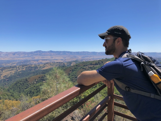
The final push to the top is on slightly steep, rocky terrain. At the top, take in that view! Standing at an impressive 3,486 feet, Umunhum offers a gorgeous panorama in all directions, from the Pacific Ocean all the way to the Sierra.

Visitors can also get an up-close view of “The Cube,” a massive radar tower that’s an iconic landmark on the Silicon Valley skyline.

The final stop is the Ceremonial Circle, a reminder of the mountain’s history as a sacred place for local Native American tribes, and a site for ceremony, prayer, and education.

After soaking up the sights, retrace the route back down to the parking lot.

The Bald Mountain parking lot is located on Mt. Umunhum Road in San Jose (map). The gate to the park opens at 7 a.m. and closes a half hour after sunset. No dogs.

Story and photos by Heather Werner, @heath.er.wer.ner

Trending Stories NorCal

View all Stories
  1. All right, Almaden!

    Take a trip through time on this 5-mile loop in Almaden Quicksilver County Park. Explore the ruins of an old cinnabar mine and enjoy the first hints of wildflower season.

    View
  2. Waterfalls and Wine Pours

    Cooler temps, green hills, and the return of our magnificent waterfalls! This family-friendly 2-mile hike at Uvas Canyon County Park in Morgan Hill is a great way to get the most out of a short hike post-rain.

    View
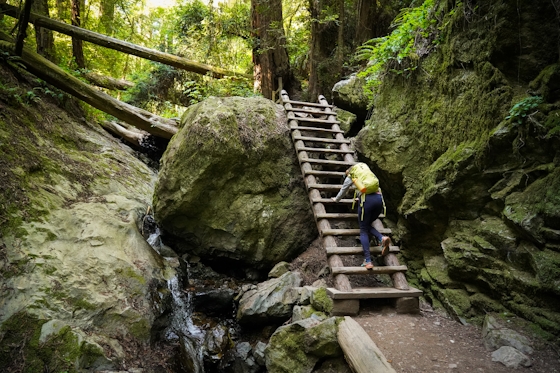
  3. Woman hiker is climbing up the ladder in the Steep Ravine section of the Dipsea Loop Trail on Mount Tam

    Misty on Mount Tam

    Mount Tam’s 3.9-mile round-trip Steep Ravine and Dipsea Trail Loop weathers the wets and wilds with some confidence, sheltered in parts by redwoods, and wowing with a waterfall.

    View
  4. Mile-Long Cataract Club

    In winter after heavy rains, the north flank of Mount Tam glows with flows. The nearly mile-long series of waterfalls—Cataract Falls—transforms into a supercharged spectacle. Starting at Alpine Dam, a 1.6 mile (one-way) narrow trails threads through redwoods and ferns along Cataract Creek.

    View

Trending Stories SoCal

View all Stories
  1. Sponsored

    Hidden Gems of Reno Tahoe

    Step into a land where adventure meets relaxation. Reno Tahoe is where the spirit of the great outdoors and the energy of vibrant city life inspire you to live with no limits.

    View
  2. Peace Labyrinth

    Hidden in LA’s historic West Adams district, the Peace Awareness Labyrinth & Gardens is a welcome respite from the norms of urban noise.

    View
  3. Weekend Sherpa Podcast: Take It Outside

    Adventure for your earbuds. What's new in the world of the outdoors? Listen to Weekend Sherpa co-founders discuss local hikes, beaches, bike rides, camping spots and all kinds of travel and adventure in California and beyond!

    View
  4. Hikers sitting on a large rock slab next to Three Sisters Falls in Cleveland National Forest Southern California near Julian

    Three Sisters

    Good things come in threes at this hike to a lovely trio-tiered waterfall in Cleveland National Forest. The 4.25-mile out-and-back hike rambles among rolling hills, with rocky mountain views as switchbacks take you down to a lush canyon and the falls.

    View