Dam Tam!
Hiking Mount Tam's Alpine Lake

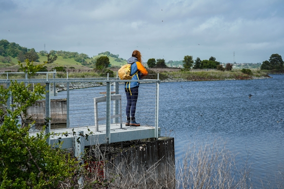
Hike in the Sierra without leaving the Bay Area! Well, at least it seems that way. The sparkling reservoirs on the north side of Mount Tamalpais offer miles of hiking trails and the kind of peaceful forest sensation that could be a stand-in for low elevation Sierra Nevada. Alpine Lake is the largest of the reservoirs and gives you some of the most beautiful and quiet scenery (it’s no wonder ospreys and the occasional bald eagle call this place home). Go on a 5.5-mile loop hike starting at Alpine Lake’s next-door neighbor, Bon Tempe Lake.
Cross Bon Tempe Dam and skirt the southern shore of Alpine Lake for the first 2 miles on Kent Trail. There are plenty of little places to pull off and picnic overlooking the lake.
A variety of ducks enjoy these parts—particularly the mohawked mergansers. Kent Trail veers east, inland and uphill through redwoods and Douglas firs. This is a solid climb for about a mile. Grand views of the bay and northern Marin greet you at the wide Rocky Ridge Road. From here it’s 1.4 miles down to the dam.
There’s an $8 entrance fee. Park at Bon Tempe Lake parking area (map). From the trailhead, veer right on the Shadyside Trail and go across the dam. At the end of the dam, turn right. In 100 feet turn right again on Kent Trail, following the shore of Alpine Lake. You’ll make a counterclockwise loop connecting with Stocking and Rocky Ridge Trails. Dog-friendly!
Bring the Outdoors to Your Inbox
Sign up for our weekly email and stay up to date on where to explore in California.
* No spam, that's a funky food!


