Bag Los Pinos
Hiking to Los Pinos Peak in Cleveland National Forest Southern California

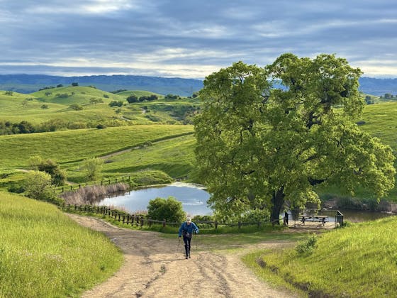
A peak all to yourself? Three words: Bag Los Pinos! This 4,500-foot peak in southeastern Orange County’s Cleveland National Forest is pleasantly private, perhaps because reaching it is a grind! But worth the workout when you peak at panoramas that’ll knock your boots off. The 5-mile out-and-back hike to Los Pinos Peak ascends Main Divide, a fire road of switchbacks that’s the center spine of the Santa Ana Mountains.
As you gain 1,000 feet in elevation, the views en route include the desert peaks of Mounts San Jacinto and San Gorgonio as well as the Orange County coast. Then come incredible views of Lake Elsinore. After 1.5 miles you’ll get to a four-way junction where you can head straight over or go around the pipe barrier and continue ascending along the unmarked Los Pinos Trail. The terrain becomes rocky, surrounded by manzanitas and the surprise sight of Coulter pines. It’s another mile of up-and-down until Los Pinos Peak. Your feat is made all the more official by a sign, rock piles, and a logbook. Round-the-compass views include Mount Baldy to the north, the Palomar Mountains to the south, and sometimes even Catalina Island in the west. Smile: Other than the soaring red-tailed hawks and darting scrub jays, it’s very likely you’ll be all alone up here. Peace of Los Pinos!
To get to the dirt parking area, from CA-74 go north on Main Divide Rd., which turns into Long Canyon Rd. Pass Blue Jay Campground and park at the next intersection, where Forest Route 3S04 begins and the upper portion of Main Divide Fire Road branches off sharply left and up. National Forest Adventure Pass required, which can be purchased at major sport stores or at the nearby Lookout Roadhouse. The hike begins on Main Divide Fire Road. Dog-friendly!
Bring the Outdoors to Your Inbox
Sign up for our weekly email and stay up to date on where to explore in California.
* No spam, that's a funky food!


