Hiker at Palm Springs Aerial Tramway

Tramarama!

Ride Palm Springs Aerial Tramway to Access Amazing Hiking

Why do hikers, boulderers, and outdoor enthusiasts love the Palm Springs Aerial Tramway? Because it quickly elevates them to the best terrain for alpine adventure! Get to the good stuff fast, with the world’s largest rotating tram swiftly whisking you to 8,516 feet and a wilderness world away in Mount San Jacinto State Park. At the top, have your pick of over 50 miles of trails, with plenty of boulders too. Summer temperatures are typically 30 degrees cooler than the desert floor, making for ideal hiking conditions.

Get Your Aerial Tramway Tickets!

Board the tram at the Valley Station (elevation 2,643 feet) and marvel at the dramatic Chino Canyon scenery en route to the heart of Mount San Jacinto State Park. It takes about 10 minutes, passing through five climate zones, and featuring stellar views of Palm Springs and beyond.

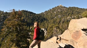
At the top, have your pick of over 50 miles of trails for all skill levels. Goodbye palm trees, hello soaring Jeffrey pines!

The Desert Valley Trail is a short 1.5-mile loop, but it packs in an incredible five viewpoints! If peak-bagging is more your form, head for San Jacinto Peak, the second highest point in Southern California. Colossal vistas stretch from the Salton Sea to Mt. San Gorgonio.

There’s hike-in camping here, too! Round Valley campground is just a 2-mile hike away, with 22 glorious camp sites waiting in a lush meadow.

But it’s not all roughing it! Fine dining is to be found here, too. You can literally whisk that special someone away with the Palm Springs Ariel Tramway. Enjoy fine dining at Peaks Restaurant, delicious drinks at the aptly named Lookout Lounge, and casual food at the Pines Café.

Trending Stories NorCal

View all Stories
  1. Muir Woods Night Tour

    Thousands of people flock to Muir Woods every year, yet only a few see it at night, when this beloved park is experienced in a whole new light. The Muir Woods Night Tour happens on the last Friday of every month through October.

    View
  2. Slide Ranch Marin

    Slide On Over

    Marin's Slide Ranch has a popular neighbor in the Muir Beach Overlook. But don’t overlook Slide! This open-to-the-public nonprofit organization sits on 134 acres of coastline and is filled with animals, Pacific scenery, and an adjacent hiking trail.

    View
  3. Sponsored

    Take the Exit to the Best of the San Francisco Peninsula

    The San Francisco Peninsula is proof that some of Northern California’s greatest surprises are hiding just off Highway 101. All you have to do is take the exit.

    View
  4. Hello, Sur!

    Big Sur is home to numerous fantastic beaches and coves, so which one do you choose? Go for the beach that's quintessential Big Sur (and dog-friendly!). Pfeiffer Beach in Pfeiffer Big Sur State Park. Its signature lilac-colored sand is waiting for your feet!

    View

Trending Stories SoCal

View all Stories
  1. Waterfall Hunter

    If you ask a local in Reno about one of the best hiking trails in town, odds are high they’ll point you to Hunter Creek Falls. It’s a year-round favorite, but it absolutely shines in spring, when desert peach wildflowers make a splash—and so does the marquee waterfall.

    View
  2. Wapama Wows

    Hetch Hetchy can be overlooked in Yosemite National Park because of its more remote location and limited facilities. But this is where you’ll also find one of the best day hikes in the park: Wapama Falls.

    View
  3. Bike the Coastal Trail to Pillar Point Harbor in Half Moon Bay

    Ride and Seek

    Oceanside breezes, beautiful beaches, a car-free pathway for biking, and beer at the end: You’re on a roll! The San Mateo Coast was made for beach hopping and beer tasting … and it all goes down smooth as part of an 8-mile out-and-back bike ride.

    View
  4. Tamtastic Sunset

    Sure, the East Peak of Mount Tam is absolutely spectacular at sunset, but some magic-hour enthusiasts are onto a fresh perspective in getting a little more personal space for their panoramic viewings.

    View