Tramp at Trampas
Adventure hike in Las Trampas

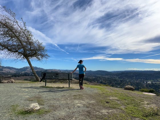
Epic East Bay views: check! Terrain with just enough challenge to keep things interesting: check! Wildflowers blooming on spring green hills: check and check! Yep, you’ll wanna tramp Las Trampas for a richly scenic 6.2-mile (round-trip) loop that goes up and down across two ridges (and one valley!) through the eastern side of the park.
You will start and finish your hike on the Chamise Trail as it switchbacks through a cattle pasture, where the friendly giants may require you to pause your trek as you coax them off the trail. As you climb, you’ll pass the Mahogany Trail on your right. But keep left and stay on the Chamise Trail, so that you can save the most difficult and possibly slippery portions of this trail for uphill pushes. Be sure to enjoy the views of the rock formations and the hills to the south as you reach the top of the first climb.
After connecting with the Corduroy Hills Trail, you will have to scramble over a few boulders with scrub on either side (this is the most technical portion of this hike and is about 50 feet of trail). The next few miles are filled with spectacular views of Mount Diablo as you descend through shaded forest and open grasslands filled with a variety of wildflowers and butterflies.
The final push of this hike is a difficult uphill dirt section (approximately half a mile), so be sure to bring enough water and take some breaks as needed. The majority of the climb is through shaded forest, and after passing the top, you’ll hike along a creek that looks inviting enough to dip your toes in after the long climb. A final short ascent will bring you back to the Chamise Trail, where you can head back to the trailhead. Stamp for Trampas!
This loop follows the trails in this order when traveling clockwise around the loop: Chamise, Las Trampas Ridge, Corduroy Hills, Madrone, Virgil Williams, Del Amigo, Sulphur Springs, Trapline, and Mahogany. Make sure to pay attention to the trail markings as this loop does intersect multiple other trails. You can find a trail map at the parking lot or on the official site for Las Trampas Regional Wilderness. Park either in the Las Trampas Staging Area (map; bathrooms and water located here) or, to save 0.4 mile of additional distance, at the Chamise Trailhead parking lot. Be sure to have plenty of water with you for this hike. This is a moderately trafficked trail and is dog-friendly although some rock scrambling is needed.


