Border Field State Park
Hike Border Field State Park in San Diego County
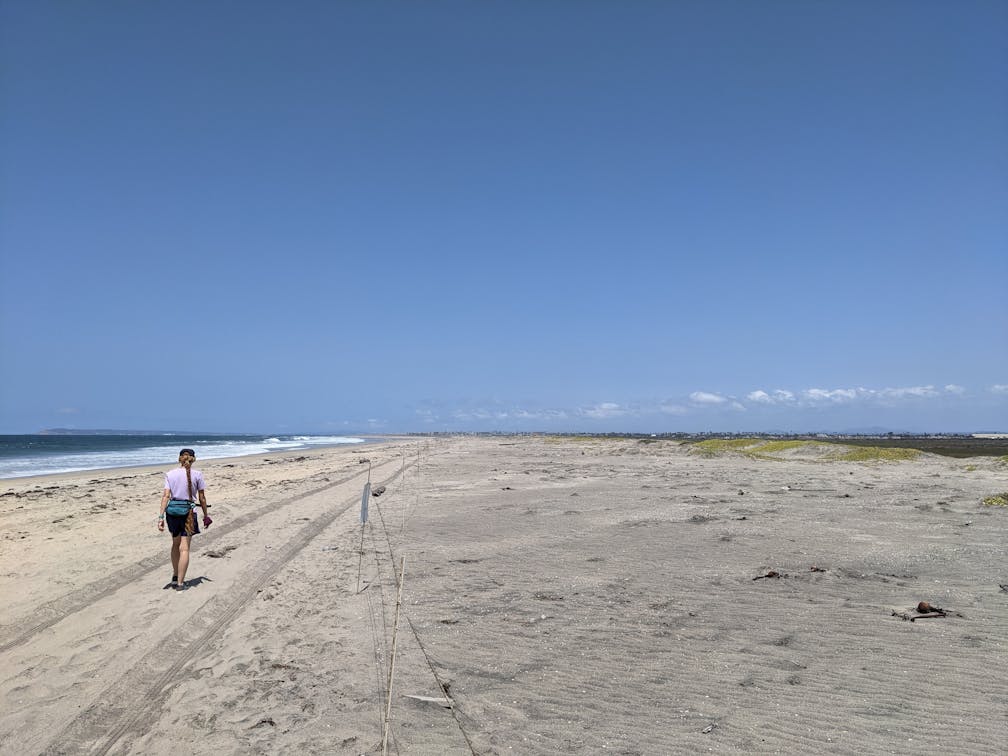
Border Field State Park, just south of Imperial Beach, is home to the southernmost point in California as well as one of the last beautiful undeveloped coastlines in the state. Visit this natural refuge that neighbors Mexico’s Playas de Tijuana suburb and go on a 4.5-mile hike featuring important history and wildlife habitats. Plus stunning SoCal beach scenery.


Park at the gated entrance to the park in a dirt lot off Monument Road (free; on weekends, you can also pay $7 to park further west to reduce your hiking mileage). Head west on the dirt road or accompanying singletrack trail, passing the park’s entrance, a trail map, and mosaic art along the fence. The path ventures through the Tijuana River National Estuarine Research Reserve, offering up-close views of riparian vegetation and resident fauna (look for swallowtail butterflies). A spur-trail, if open, provides a short 0.5-mile detour loop on your right for an additional riparian romp (a sign will indicate if it’s available for human foot traffic).


At just over half a mile you’ll reach a junction; keep right to continue toward the Pacific. The relatively flat salt and freshwater marsh preserve means expansive views to the north. Look for Imperial Beach and beyond to Point Loma. The highlight of this portion is a quaint bridge that crosses the narrow waterway of the Tijuana River. Here is one of many fantastic spots for birders. Look to the marsh for hunting great blue herons or wading green-winged teals, among other waterfowl. Sand dunes also come into view here, as you continue to the expansive sandy shore. You may not see another soul on this massive beach, which is an incredibly rare occurrence in San Diego County. Hop on some concrete ruins for photos.
Head north for 0.7 mile to reach the northernmost point of the park, where the Tijuana River reaches the Pacific. The merging of fresh and saltwater environments is also a great area to look for the threatened Western snowy plover amongst the dunes. Next, head south, passing flocks of gulls, terns, and various shore birds, such as the black-necked stilt and the American avocet. You will soon reach the international border, marked by a fenced wall of pillars stretching into the water.

Here, take the trail up the hill to Friendship Park, home to a border monument, interpretive signs detailing the history and local ecosystem, and plenty of shaded tables for a picnic. At the eastern edge of the park is a road, adjacent to those imposing border walls, that reconnects with the dirt path that takes you back to the park entrance and your car.

To get to the Border Field State Park entrance, take the I-5 to the Tocayo Ave. exit (exit 3). After 0.4 mile, turn left onto Hollister St. and take it south for 1.4 miles to Monument Rd. Head right on Monument Rd. for another 1.4 miles to the park entrance gates and dirt lot. No dogs!
Story and photos by Matt Pawlik
Bring the Outdoors to Your Inbox
Sign up for our weekly email and stay up to date on where to explore in California.
* No spam, that's a funky food!
