Bluffing Good!

Hike the San Onofre Bluffs Loop Trail in San Diego County
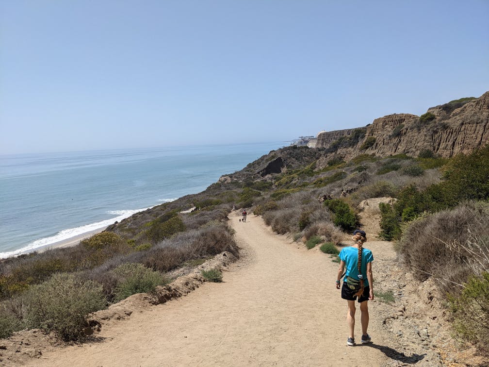
Woman hiking the San Onofre Bluffs Loop Trail to San Onofre State Beach in San Diego County

What if we told you there was a pristine stretch of coast with beautiful beaches, unique geological history, and picturesque sandstone cliffs with limited foot traffic in San Diego County? We promise we aren’t bluffing! Head to the northernmost point of the county, San Onofre State Beach, to find the 5-mile San Onofre Bluffs Loop Trail that explores both cliffs and coast.

Woman hiking the San Onofre Bluffs Loop Trail overlooking San Onofre State Beach in San Diego County

Woman sitting on a bluff top bench overlooking the Pacific ocean on the San Onofre Bluffs Loop Trail overlooking San Onofre State Beach in San Diego County

Woman walking along the sand towards a lifeguard tower on San Onofre State Beach in San Diego County

Park at one of the many lots and trailheads (there are six). We recommend Trail 1 just after the first restroom south of the park gate ($15 day use fee, or get an annual State Parks pass) and begin at the dirt path. The trail immediately offers incredible north-south views of the Pacific coastline; enjoy them from a bench before heading down the steep trail. There are often surfers at the beach because of consistent waves. To the north is the inactive nuclear power plant; try to spy San Clemente just past the rather ominous buildings.

Woman walking on the sandy beach next to a rocky section on San Onofre State Beach in San Diego County

Woman standing on a bluff overlooking the sandstone rock canyon formation above San Onofre State Beach in San Diego County

Woman walking beneath a trio of giant palm trees and the sandstone cliff formations at San Onofre State Beach in San Diego County

Head south on the sand, looking for gliding pelicans and scampering sandpipers along the water. The rugged canyon walls, sculpted by ages of winds and water, are a scenic geological gem throughout the trek. You’ll pass five trails on the beach stroll. Go up and down for more of a workout, or simply wait until Trail 6 to return to the bluff trail. Note: If the tide is high, you will have to maneuver over loose rocks; the rocky beach is a tough slog but also offers gentle, meditative sounds as waves crash and roll over the stones.

Lifeguard tower at San Onofre State Beach in San Diego County

Sign to Beach Trail 2 at San Onofre State Park in San Diego County

San Onofre Bluffs Trail overlooking San Onofre State Beach in San Diego County

Just before the Trail 2 marker, you’ll see a large gap in the bluffs. This is the Cristianitos Fault. There’s also a notable change in rock color—the light hues of the silt and sandstone San Mateo Formation lie to the north, while the Monterey Formation to the south offers much darker claystone cliffs. Continue past the earthquake fault line, which hasn’t been active for over 100,000 years (and we hope it stays that way!), until you reach your Trail 6 ascent. Along the bluff trail on the return trip, pass multiple vista-friendly benches and the San Onofre Bluffs Campground, a serene overnight option with 157 sites (reserve in advance) for those who find it tough to leave the bluffs. ’Nuff said!

To get to the San Onofre Bluffs Loop, parking lot, and campground, take exit 71 (Basilone Rd./San Onofre) off the I-5. Turn left (if coming from San Diego) or right (if coming from the north) and follow the Old Pacific Highway south for just under 3 miles to the park entrance. Always be aware of the tides. Dog-friendly!

Story and photos by Matt Pawlik

Trending Stories NorCal

View all Stories
  1. All right, Almaden!

    Take a trip through time on this 5-mile loop in Almaden Quicksilver County Park. Explore the ruins of an old cinnabar mine and enjoy the first hints of wildflower season.

    View
  2. Waterfalls and Wine Pours

    Cooler temps, green hills, and the return of our magnificent waterfalls! This family-friendly 2-mile hike at Uvas Canyon County Park in Morgan Hill is a great way to get the most out of a short hike post-rain.

    View
  3. Woman hiker is climbing up the ladder in the Steep Ravine section of the Dipsea Loop Trail on Mount Tam

    Misty on Mount Tam

    Mount Tam’s 3.9-mile round-trip Steep Ravine and Dipsea Trail Loop weathers the wets and wilds with some confidence, sheltered in parts by redwoods, and wowing with a waterfall.

    View
  4. Mile-Long Cataract Club

    In winter after heavy rains, the north flank of Mount Tam glows with flows. The nearly mile-long series of waterfalls—Cataract Falls—transforms into a supercharged spectacle. Starting at Alpine Dam, a 1.6 mile (one-way) narrow trails threads through redwoods and ferns along Cataract Creek.

    View

Trending Stories SoCal

View all Stories
  1. Sponsored

    Hidden Gems of Reno Tahoe

    Step into a land where adventure meets relaxation. Reno Tahoe is where the spirit of the great outdoors and the energy of vibrant city life inspire you to live with no limits.

    View
  2. Peace Labyrinth

    Hidden in LA’s historic West Adams district, the Peace Awareness Labyrinth & Gardens is a welcome respite from the norms of urban noise.

    View
  3. Weekend Sherpa Podcast: Take It Outside

    Adventure for your earbuds. What's new in the world of the outdoors? Listen to Weekend Sherpa co-founders discuss local hikes, beaches, bike rides, camping spots and all kinds of travel and adventure in California and beyond!

    View
  4. Hikers sitting on a large rock slab next to Three Sisters Falls in Cleveland National Forest Southern California near Julian

    Three Sisters

    Good things come in threes at this hike to a lovely trio-tiered waterfall in Cleveland National Forest. The 4.25-mile out-and-back hike rambles among rolling hills, with rocky mountain views as switchbacks take you down to a lush canyon and the falls.

    View